GIS-Based Asset Management Program
Ledyard, Connecticut
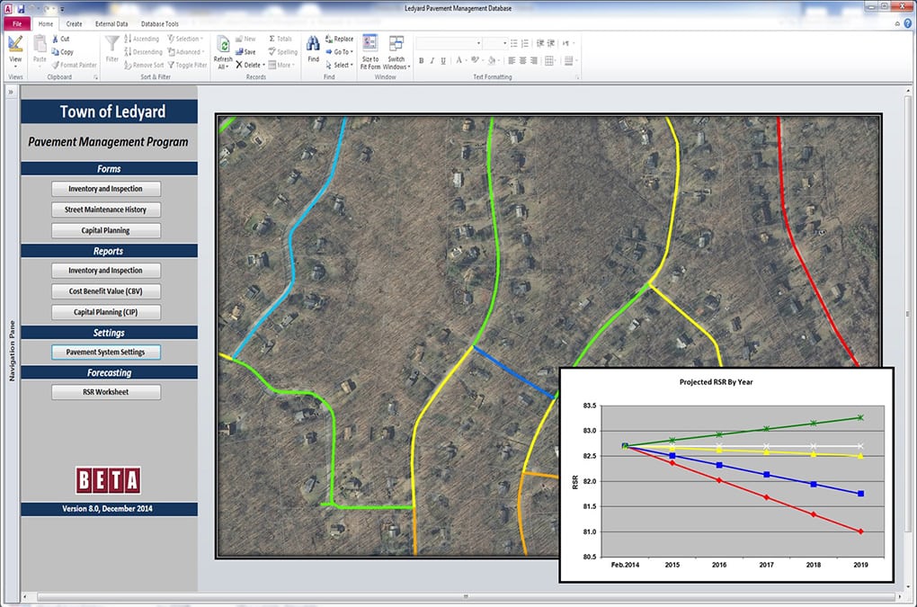
BETA worked with the Town of Ledyard to develop a Pavement Management System for its 134-mile roadway network. The program was developed utilizing BETA’s customized Microsoft Access application. This GIS-based program provides Ledyard with the opportunity to synthesize pavement condition data with other descriptive information on a host of related roadway elements such as drainage and street signs to assist with capital improvement planning.
As part of the initial project setup, BETA conducted a GIS needs analysis for the DPW. This involved compiling all available data services and making recommendations with respect to GIS data layers and software needs.
All of the functions of the pavement management program are run from a main switchboard dialog box. From this switchboard, users can access specialized forms for entering pavement inventory data, modify the Road Surface Rating (RSR) calculation parameters, and enter possible repair methods and budgeting information. Users can also access reports directly from the main switchboard. Reports can be sorted by a variety of parameters, and can be customized to the needs of each individual user.
The final deliverable for this project, in addition to the pavement data elements, is a report that summarizes the system findings of the pavement. This includes presenting information related to software capabilities, data collection methodologies, existing pavement and programming/budgeting operations.