Pavement & Asset Management System
Hartford, Connecticut
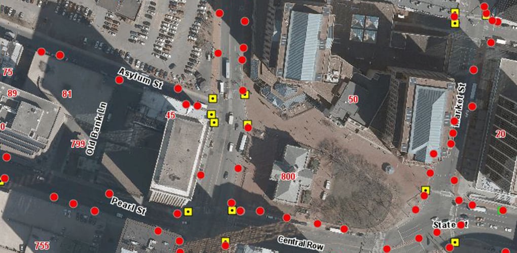
The City of Hartford retained the services of BETA to develop a comprehensive Asset Management System. Utilizing a Web-enabled GIS application, developed in conjunction with People, GIS, BETA collected existing condition information for assets such as regulatory and warning signs, street name signs, wheelchair ramps, sidewalk distresses, median islands, and guard rails. The use of the web-enabled GIS program allowed BETA to track progress in real-time while working simultaneously to quality control incoming data as well as perform in-office coding. The project also included updating the Pavement Management Program with a 2013 baseline, and Backlog Summary for the City’s 220 roadway miles.
The City of Hartford requested that a portion of the field data collection be performed using interns who were also City residents. BETA trained and managed the interns while working side by side to collect the data both efficiently and accurately. A comprehensive training program was conducted with the interns as a benefit to the project and also providing the high school students with a learning experience.
In collaboration with the City, BETA was able to develop custom field inspection forms for each of the assets to be collected. The project resulted in the location and documentation of more than 13,000 signs, 3,500 curb ramps, and 19,000 sidewalk maintenance locations.