Town-Wide Drainage System Mapping
Bloomfield, Connecticut
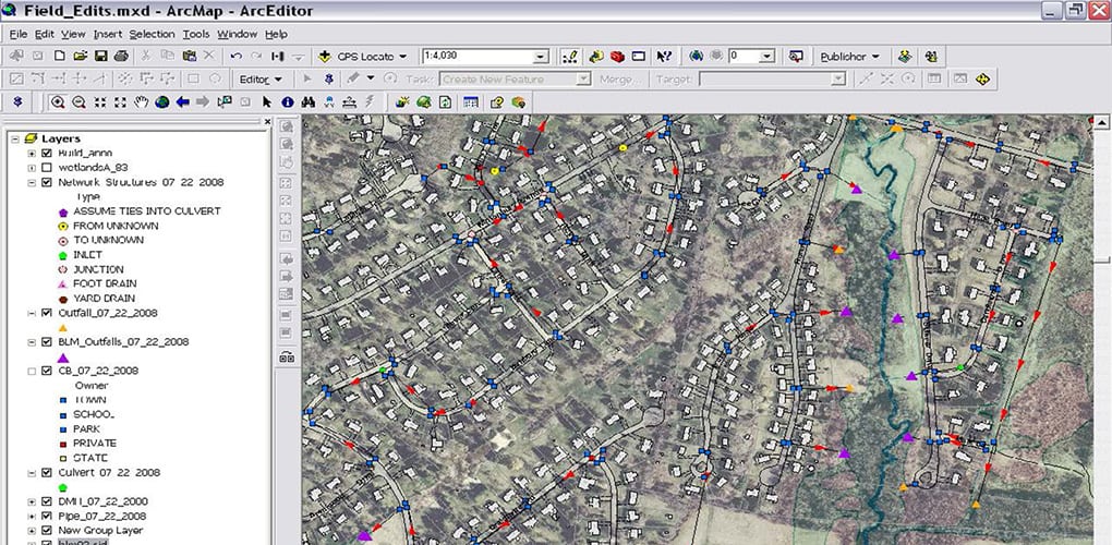
The Town of Bloomfield retained BETA to develop a town-wide Geographic Information System (GIS) data layer of the municipal stormwater collection system. Stormwater structures, including catch basins, manholes, and outfalls were located using the Town’s 40-scale mapping. Missing structures were located through sub-meter global positioning systems (GPS). A detailed inspection of each structure was also performed to obtain additional attribute information such as pipe size, material, and direction of flows.
The final deliverable for this project, in addition to the town-wide GIS data layer of the municipal stormwater collection system, included an ArcView Geodatabase and customized system plans.