Complete Streets Program
Clinton, Massachusetts
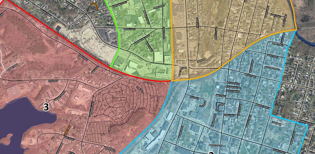
The Town of Clinton, Massachusetts wanted to better understand the nature of its infrastructure and explore opportunities for developing a more cohesive network of streets and sidewalks, in the form of promoting Complete Streets. BETA inventoried 25 miles of the Town’s streets, focusing primarily on those emanating from the Historic Downtown. Streets were inventoried, surface condition assessed, and rated to develop a comprehensive overview of overall conditions. To read more about our findings, click here to read our Clinton, MA Complete Streets project profile: clinton-complete-streets.
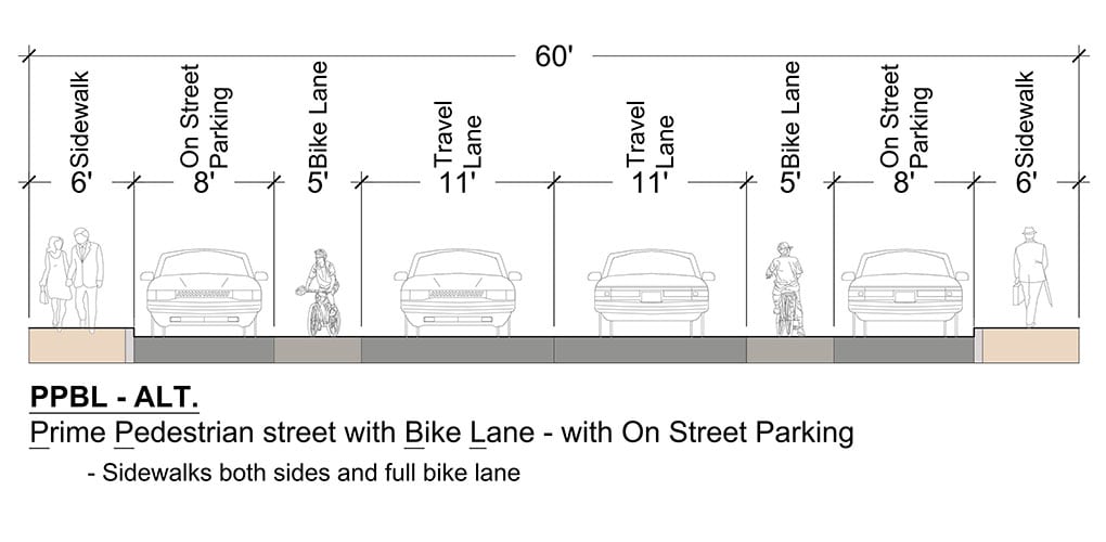
BETA developed a series of matrices organized to rank streets on jointly developed criteria for walkability, civic connectivity, bicycle opportunity, as well as access to recreational areas, retail areas, grocery stores and healthcare facilities. Streets accumulated a composite score, which afforded the Town a basis to develop a list of “Complete Street Corridors” and focus priorities.
A key aspect was to look more deeply at the core objectives of Complete Streets, one of which is the creation of transportation equity, or allowing for choice for various modes of transportation, particularly developing transportation equity for underserved Low to Moderate Income populations in Clinton.
The final products developed included Street and Conditions mapping for the project area, Asset Inventory and Analysis reports based on the GIS field work conducted by BETA, and a Narrative Summary with the matrices developed during the project, with roadway rankings and composite scores. The Narrative Report prepared included tiered recommendations and highlighted various projects for enhanced connectivity and the development of a Complete Streets network in Clinton.