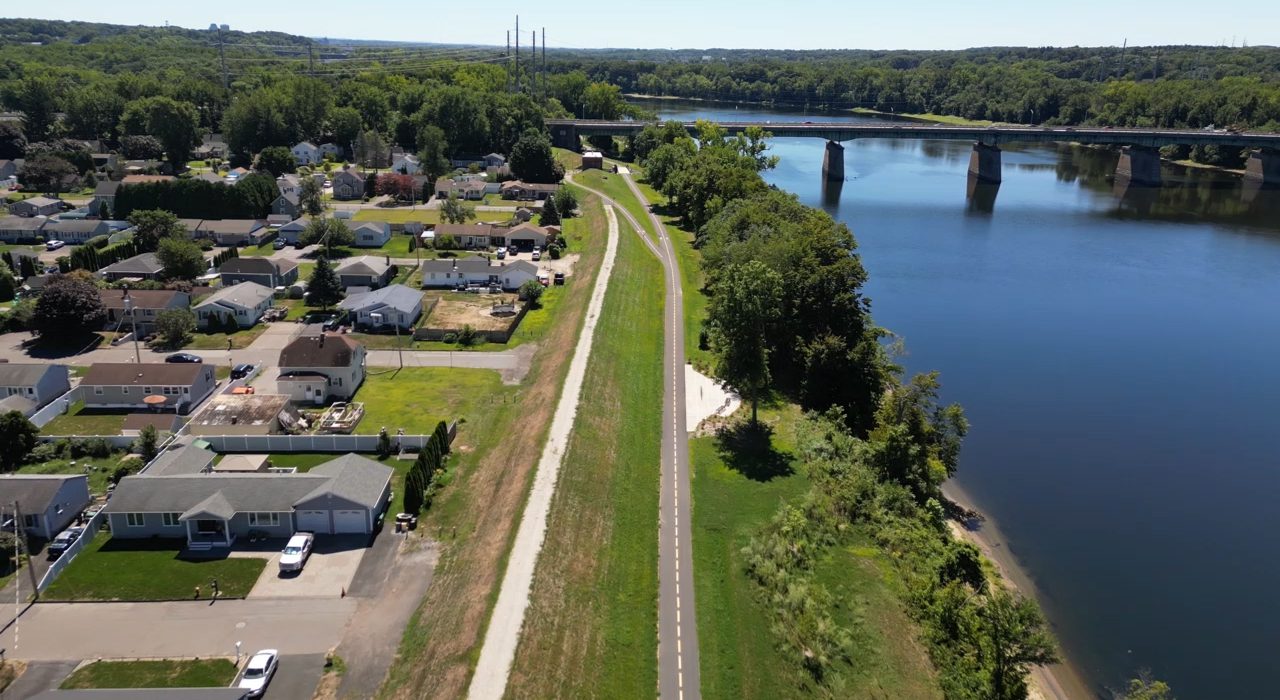
Connecticut Riverwalk North
Chicopee, Massachusetts
Utilizing CDBG funding, the City of Chicopee hired BETA to design a multi-use path along a 2.8-mile corridor adjacent to the Connecticut River. This segment is part of a planned 20-mile multi-use corridor along the Connecticut River through Springfield, Chicopee, West Springfield, and Agawam. The project is within the Chicopee flood control district and is adjacent to an existing flood control dike. Key elements of the design included the grading of the path to avoid impacts to the flood plain, connections to a state boat ramp at the southern end, and connections to Nash Field at the northern end.
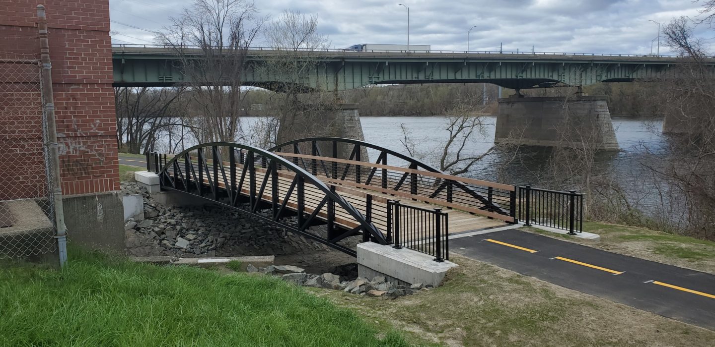
The alignment passes over the outfall channel of a stormwater pumping station. A prefabricated bridge was proposed to carry the path across the 65-foot span. Other components included designing connections across the dike to connect with the adjacent neighborhood streets. As with the path itself, these connections will meet Americans with Disabilities Act (ADA) requirements. The project included overlook areas at strategic locations along the river, including an existing bald eagle’s nest. Also included is the installation of interpretive signage to highlight the historic significance of the flood control system and the Connecticut River. Lastly, the project has included an extensive public outreach program.

