Regional GIS & Asset Management Program
SCRCOG Region
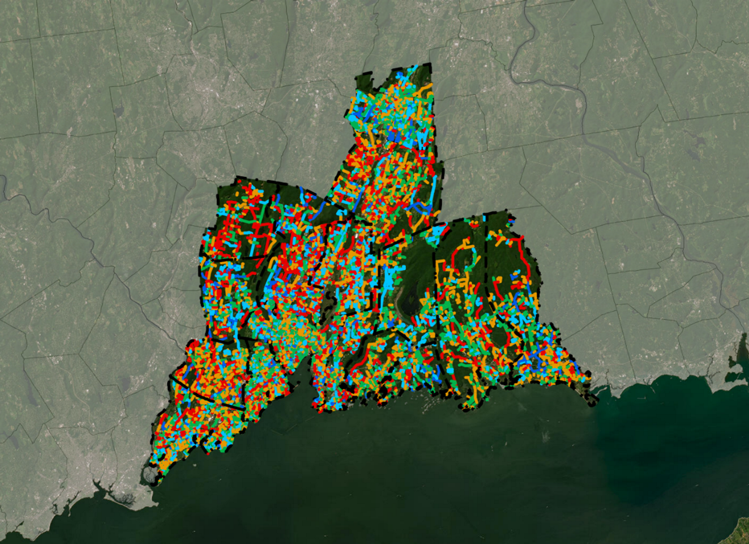
BETA is currently providing GIS, pavement management, MUTCD sign inventory, and support services to communities within the SCRCOG region. The SCRCOG region consists of 16 communities located along the I-95 and I-91 corridors in the vicinity of New Haven, CT. The first step in the project involved a series of workshops with SCRCOG GIS staff and participating communities to develop a comprehensive database design.
BETA’s GIS-based Pavement Management Program, coupled with PeopleGIS’s Maps Online application, is the software being used for this effort. It provides the user with the opportunity to synthesize pavement condition data with other roadway elements such as sidewalks, utilities, guard rail, and other related infrastructure. The user-friendly program also allows for data to be viewed through a GIS and MS Access interface. Ultimately, the System is structured to allow for a wide range of capital improvement planning (CIP) scenarios and thematic maps to be developed.
All of the functions of the pavement management program are run from a main switchboard dialog box with MS Access. From this switchboard, users can access specialized forms for entering pavement inventory data, modifying the road surface rating (RSR) calculation parameters, and entering possible repair methods and budgeting information. Reports and GIS maps can be developed using a variety of parameters and can be customized to the needs of each individual user.