Tidewater Master Planning
Pawtucket, Rhode Island

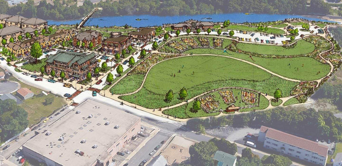
BETA was hired in 2014 by the City of Pawtucket to develop a master plan for adjacent two riverfront parcels, one owned by the City and one owned by National Grid. Both sites contain hazardous materials and soils due to over 200 years of continuous petroleum handling, industrial activity, and coal gasification operations. Combined, the “Tidewater Site” is approximately 15 acres in size, with over 1,600 linear feet of shoreline along the tidal Pawtucket River.
Extensive coordination with numerous subconsultants, including National Grid’s site remediation team, has led to several creative land use solutions. Through a series of public meetings (one by boat), the re-use options are currently being fine-tuned to provide a mixed-use master plan that connects the surrounding neighborhood and schools to the river, while extending a bike trail and expanding the Pawtucket Riverfront Greenway.

