
Former Uniroyal Facemate Facility Brownfields Redevelopment
Chicopee, Massachusetts
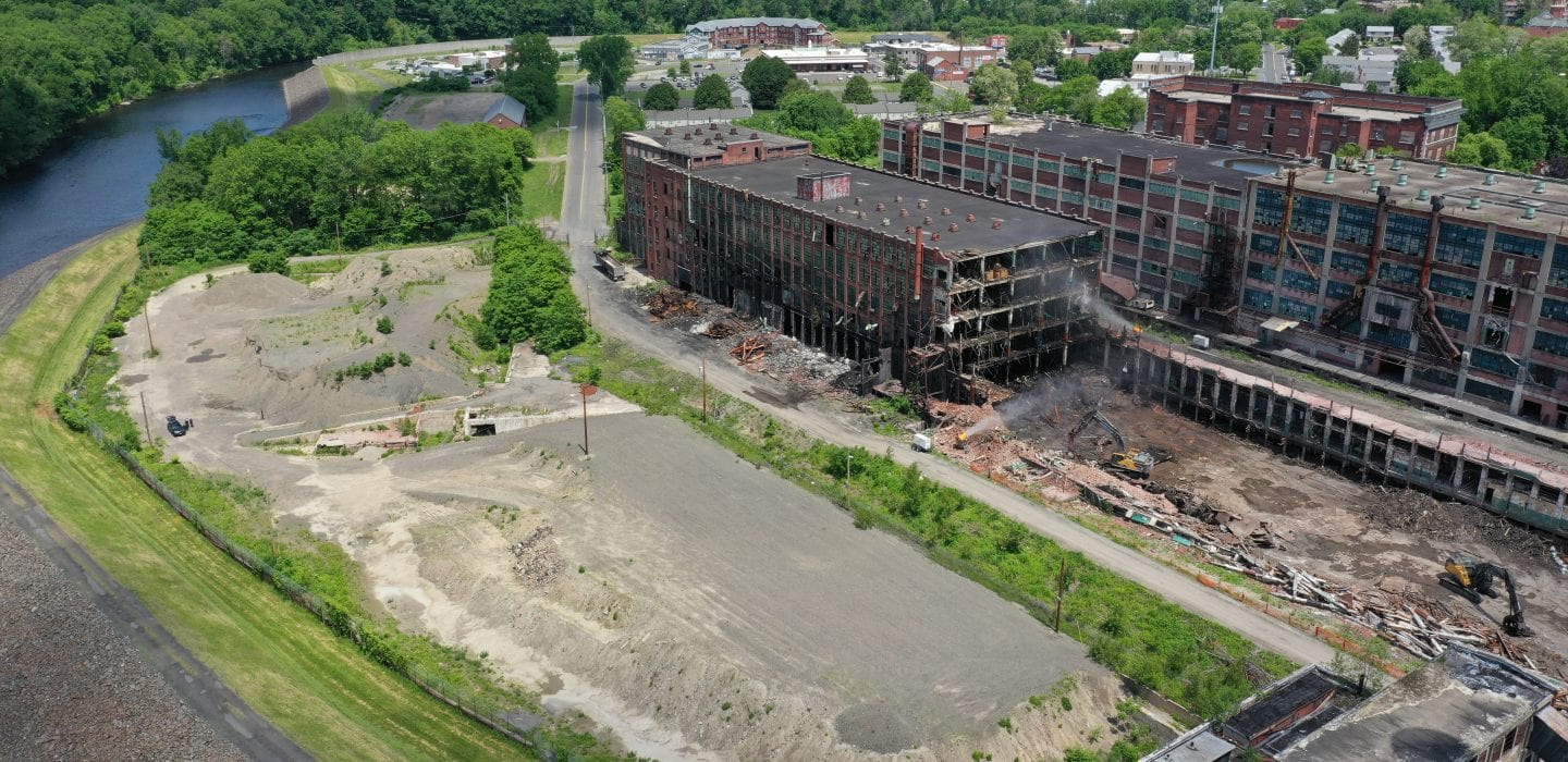
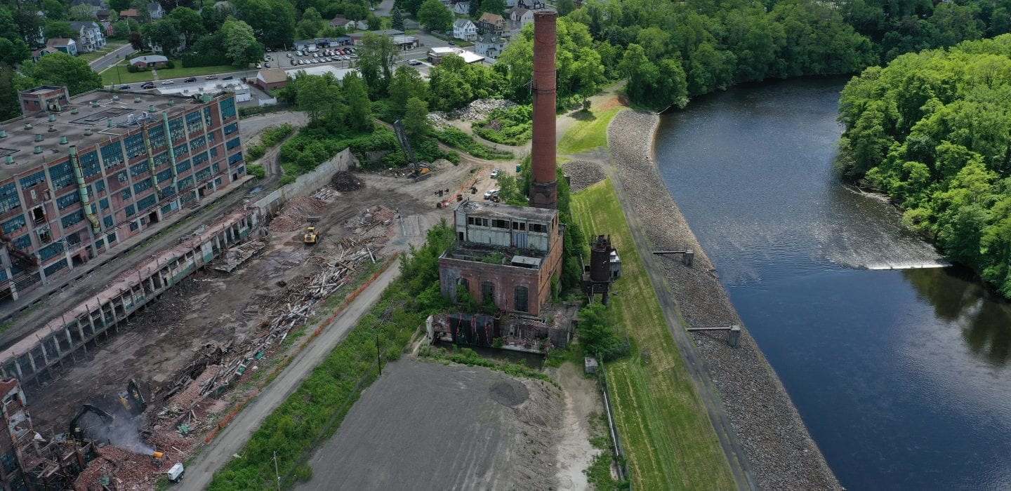
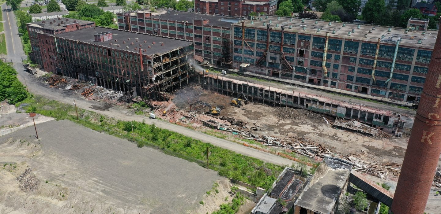
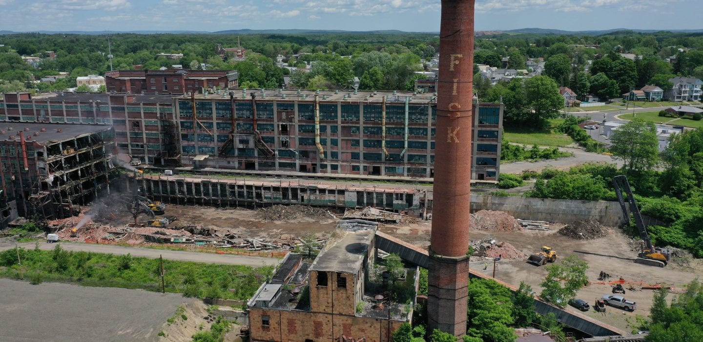
BETA is working with the City of Chicopee on engineering and environmental consulting support for the environmental and response actions related to the former Uniroyal and Facemate properties. The project site consists of more than 70 acres adjacent to the Chicopee River that has been vacant since 2003. This is one of the projects targeted by MassDEP for cleanup and future redevelopment under the Lt. Governor’s Brownfield Support Team (BST) initiative. It has also received funding from MassDevelopment ($4 Million), EPA ($800,000), and the HUD Section 8 Community Development Block Grant Program ($10 Million).
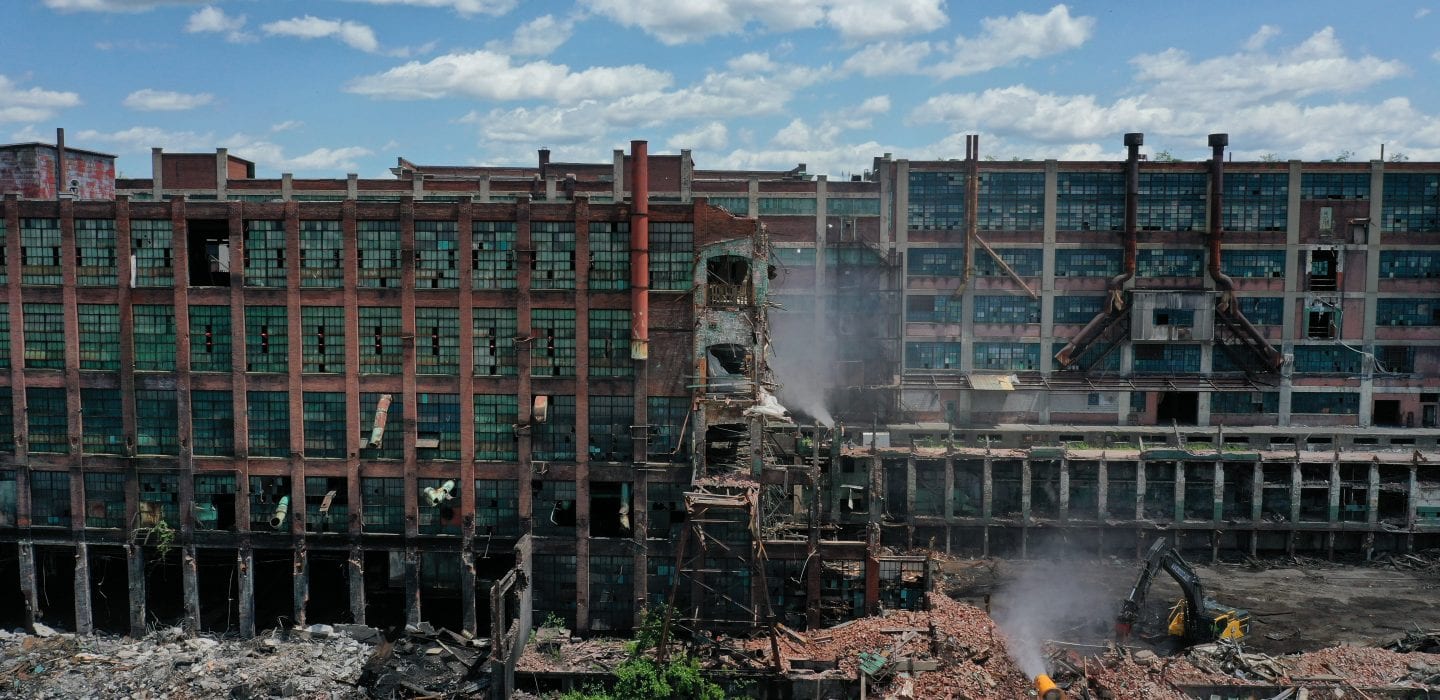
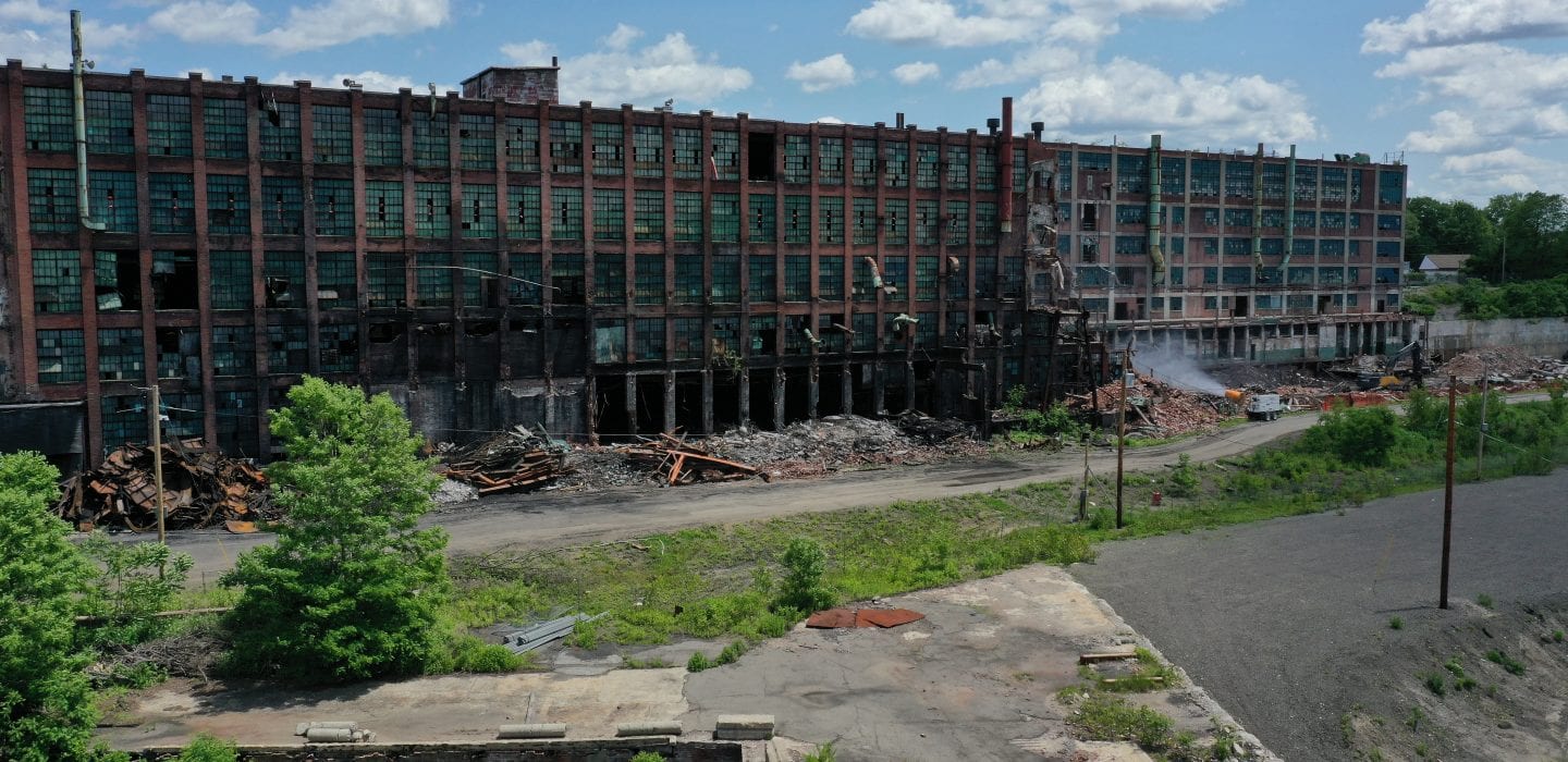
The former Uniroyal site had been used as a tire manufacturing plant from the late 1800s until the property was sold in 1981 and used by various companies for manufacturing, printing, machine shops, office, storage, and health care facilities. Likewise, the former Facemate site had been used for textile manufacturing since the early 1800s. Because of its historical uses, the property included numerous areas of environmental concerns, including partially collapsed abandoned buildings, former PCB-containing equipment, existing underground storage tanks (USTs), abandoned railroad rail lines, and various underground structures (i.e. former building foundations, canals, penstocks, and tail races that were filled circa 1950).
BETA conducted an initial environmental review that involved extensive research of historic uses of the property and prepared an ASTM Phase I ESA Report documenting existing site conditions and areas of concern. A supplemental subsurface investigation program was subsequently conducted to help assess “suspect” areas identified during Phase I. Key elements of the cleanup include on-site consolidation of asbestos and PCB-impacted debris (with a Self Implementing Plan under TSCA regulations and a RAM Plan under MassDEP Waste Site Cleanup regulations), and a Special Waste Determination under MassDEP’s Solid Waste regulations.
Site activities have also included structural analysis of existing buildings, asbestos and hazardous materials inspection, abandoned UST removal, RCRA hazardous waste cleanup, groundwater and soil sample collection, well installation monitoring and sampling, soil borings, and test pitting. The Iron Horse Preservation Society (IHPS) was also involved, at no cost to the City, to remove existing railroad ties and rails on most of the subject property.
The locations of site activities have been geo-referenced using GPS in order to create a site plan containing details on all information collected on the property. This cohesive plan has been compiled to help developers determine possible uses of the property based on remaining environmental site conditions. Successful development of a portion of the site has already been achieved through the construction of the RiverMills Senior Center by the City of Chicopee and the RiverMills Assisted Living at Chicopee Falls by a private developer. A third parcel is in the process for mixed-use development and includes a 107-unit apartment building, indoor sports complex, brewery, and restaurant.

